“What a course… the first half draws you in, and the second half BEATS YOU UP!”
Kevin Ashton – 2017 finisher.
The course has evolved and is now one large loop starting and ending at the Mount Morris Dam Visitor Center at 6103 Visitor Center Road in Mount Morris NY. The course will be around 45 miles.
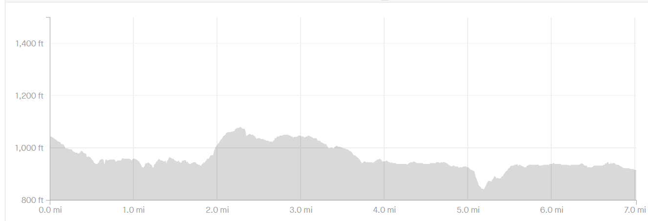
*** This course will have upwards of 6,000 feet of elevation gain. It will be well marked with race specific flags and signs. Each runner will be given detailed course descriptions and major intersections will be marked.The course is also on Avenza Maps. If you download the app “Avenza Maps“, you can install the route on your phone and see where you are on course in real time.
Full Course Route

5 Aid Stations will be stocked with standard “Ultra Food” and 2 “micro stations” which will include water/gu/gels
“Chuck” an aid Station. In continuation of Chuck Ward’s 2019 race in which he wrote a thank you note to each aid station – We ask you carry on the tradition and do the same. “Chucking an aid station” is be a MOTG Tradition
Chips -Pretzels- Candy -Pickles_ Salt/E-tabs – Water – Banana – Oranges -Electrolyte drink
| Section Directions | Mileage |
| Start to Overlook waterdrop MicroStation Head north on the yellow blaze Finger Lakes Trail towards the FLTC headquarters for .18 turning left onto the wildlife loop – Continue on the FLT (Yellow blaze) At .35 miles and follow the sign to the left for the FLT.
At .57 miles and turn sharp left to stay on the yellow FLT at the sign that points to Mt. Morris At 1.26 miles, left at the fork, and then another left at the next junction. at 1.4 miles you see a cabin, go right to follow the yellow blazes. AT 1.58 head down sickle road (steep winding downhill ABSOLUTELY NO CREW ACCESS) Blazed yellow all the way to the Genesee Valley Greenway. At 1.9 miles turn left onto the Greenway and take the footbridge across the river. Once you cross the river, you will turn left (at 2.15 miles) out of the greenway parking lot to head back south by climbing into the park on the Green Trail. Follow the Green trail for about 1.5 miles to the Overlook water drop. There will be some gels and water at this location. Bathrooms are located here as well. PROFILE ELV GAIN 381 feet |
Section: 3.7
Total: 3.7 |
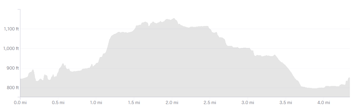
| Overlook waterdrop to to High Banks aid station
Starting at the Dam Overlook, runners will take Trail 20 (marked with green paint) along the gorge. Trail 20 will turn into beautiful single-track, and at the top of a hill turn left onto trail 19B. This drops you down through some newly built trails that are marked with red and green markers. Follow 19B and in about 3/4 mile, you will come to another fork in the road. Take the trail straight following the signs for trail 19. About a quarter mile down, there is a very short spur trail to the left with an overlook of a beautiful waterfall (called Paper Mill Falls). Continue on trail 19 and bear slightly left at the next intersection. You will run past an old Civilian Conservation Corps (CCC) barracks (all that’s left is the chimney!) and down to the Silver Creek Outlet. Cross the creek, pass by a beautiful waterfall and take Trail 18 up the hill. Make a left to stay on 18 (do not go out to the road over the wooden bridge like previous years) You will continue up hill for a quarter of a mile before making a right up a grassy embankment, and turning right onto the camp road. Stay on the camp road for a mile and change to get to aid station number 1. There are bathrooms behind the camper check-in building. *** Any section along the road is not to be run on the shoulder nor the road. *** Course Cut-Off and aid station closing is 8:15am.
Elevation gain: 564 feet |
Section:6.3
Total: 10 |
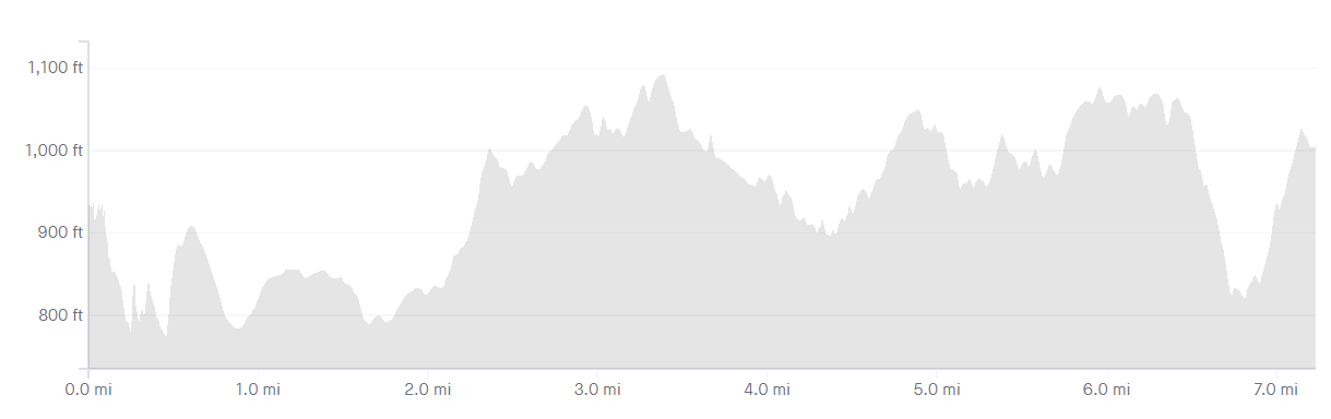
| High Banks to Tea Tables aid station
This next stretch is our longest stretch without aid. There are places along the way for you to fill your water if you need – There is a MicroStation at the road crossing at trail #11 – water and gels. Take Trail 17 down and it will connect with Trail 15, which will eventually loop back up toward the road (via a huge climb). This section will take about 2.75 miles. Leave the aid station and miles Go left onto the road and enter the new trail 15a. This segment is 3.45 miles . Cross the road at trail #11. Stay on trail 11 (for about 1.5 miles) all the way back to Park Rd. Crossing it, making a right and entering Trail #13 Make a left on Trail 13(for about 1 mile) which will cut down to Trail 1 and the St. Helena Picnic Area, there are also bathrooms here. Continue uphill on trail #1 along the edge of the gorge for .5 miles and this will bring you to the tea tables area and aid station #2 *** Any section along Park Road is not to be run on the shoulder nor the road – Runner must follow the course which will hug the tree line off of the road *** Cut off and aid station close at 11:00 am ELEVATION CHART HERE TBD Elevation gain TBD |
Section ~9.1
total miles ~ 19.1 |
| Tea Tables to Lower Falls Aid Station –
Continue on Trail 1 (the gorge trail). You will pass through several beautiful areas where your crew can also see you and cheer you on. You will go through the Tea Table Area, Wolf Creek Area, you will cross a bridge over Wolf Creek, climb some stairs, and then continue on Trail 1. Pass the Great Bend Overlook, and stay on Trail 1 toward Lower Falls. At the Adventure Calls office you will square around the parking lot and run past the lower falls bathroom/shelter. Continue on the trail up the stone stairs. At the second set of stairs, take the right set leading up to the Octagon Shelter, adjacent the playground. (you must go right to the pavilion, otherwise you skip the aid station and be spit out onto steps down to footbridge). This is where your drop bag will be if you brought one. COURSE CUT OFF You must be OUT of the aid station at Lower Falls and on the stairs by noon – Not a minute later. This means you have 6.5 hours to cover the first side of course. Once you leave this aid station the course becomes remote and while you can drop (and hike to the road for pick up) There are also cut offs on the other side – An official finish at this point means making it to the finish before 8 pm (14.5 hours) Cut off and Aid Station Closes at 12:00
Elevation gain ~1,000 |
Section ~4.5 miles
Total Miles ~23.6 |
| Lower Falls to Lean-to some aid.
Hopefully you’ve enjoyed the crew support because you are now crossing the river to the more remote area of the park. You will leave the aid station at Lower Falls Octagon Shelter and pick up the trail to lower falls here. Follow the trail towards lower falls and take 127 steps down to an incredible stone bridge across the river. Running down the stairs is prohibited as they are old, crumbly and can be slippery. Take your time and enjoy the scenery here. Across the bridge, Trail 6A connects and you begin the climb out of the gorge. Continue on trail 6A which climbs to the road on beautiful single track next to stunning waterfalls. At the top of Trail 6a, you will turn left onto the beat up park road. Run down this rolling road eventually making a right towards the remote cabins of the park (crew are prohibited from entering the cabin area – you must stop before the right hand turn). Trail #9 is on your right hand side in between a few cabins. (there is a water spigot here if you would like to refill, consider it you won’t have aid for a bit) You will climb trail #9 (Dish mill creek) taking a right to stay on #9 where you will run for 1 mile all the way up to River Road. Making a left onto River Road (crew are prohibited on this section of river road – please follow directions from park to river road access) and then quickly making a left onto the Finger Lakes Trail. Staying on the FLT for about 3.5 miles to the Lean-to and your next aid station. The FLT is blazed yellow – There are several off shoots that are blue that you will not be taking. Stay on the FLT. Course cut off and Lean – to aid station closes at 3:00pm
Elevation gain ~1,000 |
Section ~7.2 miles
Total Miles: 30.8 |
| From Lean to Some Aid to the Final Countdown Aid Station
Leaving the Lean-to, make a left on the yellow blazed Finger Lakes Trail to continue north. This begins the most difficult stretch of the race – This section is 7ish miles long – Please consider what you will need for this stretch. You will remain on the the yellow blazed FLT this entire stretch. DO NOT turn on any blue trails. Course Cut off and Final Count Down Aid Station closes at 6:00pm
Elevation gain ~1,100 feet |
Section ~7
Total Miles ~37.8 |
| From The Final Countdown Aid Station to the Finish
Continuing North again on the FLT – Once you leave the aid station you will follow the FLT North all the way to the parking lot at the Mount Morris Dam. At the trail head – you will turn a sharp right hugging the parking lot for a few hundred feet before making another right in to the finish line. High-Five Eric and Sheila and celebrate with a specialty event beer from Genesee Brewing Company and Vegan Garbage Plates from DogTown. The finish line closes officially at 8:00pm 14.5 hours after the race starts.
Elevation gain ~550 Total Course Elevation Gain: |
Section~7 miles
Total Miles ~44.8 |